Home | Contact Us | About Us | Join CELP | Ralph W. Johnson
Center for
Environmental Law & Policy
Rush for Water
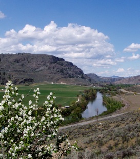
Tunk Valley is notable for water scarcity. Water that flows in Tunk Creek originates in the basin as either snow melt or rainfall. Pumping more groundwater could lower the water table and impact Tunk Creek flows. Demands for water are higher during the late summer and fall – when stream flows are lowest.
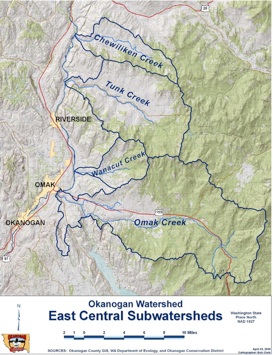
Tunk Creek is an important tributary to the Okanogan River. The stream supports rainbow trout and other fish. In the lower reaches of the Tunk Creek, endangered steelhead spawn. The Okanogan Watershed Plan documents that the "best redds” are found just downstream of where East/Central sub-basin tributaries, including Tunk Creek, enter the Okanogan River.
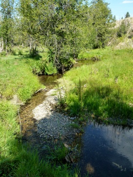
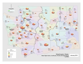
Water claims and water rights far exceed the physical water flowing in Tunk Creek. The streamflow during the dry months is diminished to as little as 0.02 cubic feet per second (cfs). There are claims to over 800 cfs, in addition to almost 3 cfs of water rights to Tunk Creek. Many of these claims do not require a water right because they were filed pre-1917 Water Code for the purpose of stock watering.
In the 80's, there were only about 25 wells in the 53,000-acre Tunk Valley. Now, the number is closer to 150 or 200. New wells risk lowering the water table, threatening older wells and flows in Tunk Creek, harming habitat for sharp-tail grouse and fisheries.
Given water scarcity and Okanogan County’s proposal to zone Tunk Valley for real estate development on 1 and 5-acre parcels, the following issues of law come into focus:
(1) Planning and Enabling Act RCW 36.70.330
... The land use element shall (also) provide for protection of the quality and quantity of groundwater used for public water supplies
(2) Critical Areas Ordinance (CAO) Requirement RCW 36.70A.060
Okanogan's current draft of the Critical Areas Ordinance does not meet its GMA requirement to protect Critical Recharge Areas as well as threatened/endangered species, including the sharp-tail grouse.
The County's CAO is not legally defensible. It does not identify a single CARA in Okanogan County. Habitat and species (including federally endangered steelhead and state threatened sharp-tail grouse), are not protected. Virtually all land uses are exempt from critical areas review, except subdivisions.
(3) Instream Flows. There is a closure on Tunk Creek that qualifies Tunk Creek for Instream Flow protections and from over-appropriation.
The Washington Department of Ecology adopted an instream flow program for the Okanogan River Basin during 1976, which is codified as Chapter 173-549 of the Washington Administrative Code (WAC). The rule, last amended during 1984, closes many tributary streams seasonally to further appropriation. Tunk Creek is within the Lower Okanogan River management unit and is closed to further appropriation from May 1 to October 1. An exception is made for single domestic and stockwatering uses. (This closure is cited in the Colville report on Water Rights on Tunk Creek.)
(4) Supreme Court Kittitas Decision. (Kittitas County et al, v The Eastern Washington Growth Management Hearings Board et al)
On July 28 the Washington State Supreme Court ruled that Kittitas County must adopt a comprehensive plan and development regulations that are protective of groundwater, pursuant to Growth Management Act (GMA) laws.
In upholding the Eastern Washington Growth Management Hearings Board’s invalidation of the County’s regulations, the Court concluded that “the County is not precluded and, in fact, is required to plan for the protection of water resources in its land use planning” and that the County’s evasion of water permitting laws “could come at a great cost to the existing water rights of nearby property owners . . . if subdivisions and developments overuse the well permit exemption, contrary to the law.”
References:
-
-Kittitas County v. E. Wash. Growth Mgmt Hearings Bd. (State Supreme Court Ruling, July 28, 2011)
-
-Rachael Paschal Osborn, Hydraulic Continuity in Washington Water Law. Idaho Law Review, Vol 1, 47th edition.
Links: